state of nevada maps

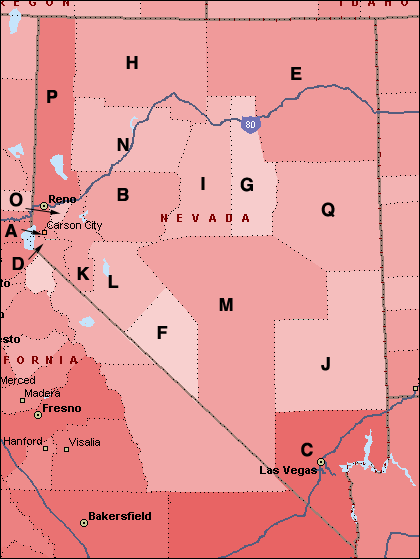
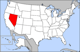
Nevada. A state of the western United States. It was admitted as the 36th state on 31 October 1864. Part of the area ceded by Mexico to the United States in 1848, it became a separate territory in 1861 after an influx of settlers drawn by the discovery (1859) of the Comstock Lode. Carson City is the capital and Las Vegas the largest city. Population: 2,700,551 (July 2014)

State Flower: Sagebrush - State Motto: All for Our Country - State Nickname: Sagebrush State; Silver State; Battle Born State - State Bird: Mountain Bluebird


If you know anyone in Clark County who needs paintless dent repair Las Vegas, have them give Mobile Dent Repair Las Vegas a call.


Weather Search countymapsofnevada.com
Custom Search


- Your Ad Here

Counties:

A. Carson City
B. Churchill
C. Clark
D. Douglas
E. Elko
F. Esmeralda
G. Eureka
H. Humboldt
I. Lander
J. Lincoln
K. Lyon
L. Mineral
M. Nye
N. Pershing
O. Storey
P. Washoe
Q. White Pine

Full color State of Nevada county maps, list of cities towns and county seats

nevada state map

nevada usa location


Advertise with Us Contact Us
Full Color County Maps - countymapsusa.com

Design & Hosting by:
pitt
©2005-2017 Thanks to Apexmetalsigns.com for keeping the lights on.